2016: 31 JAN & 7 FEB
OgImage:


Public Consultation held 31st January 2016 in Kelsey Hall, Ifold and 7th February 2016 in Winterton Hall, Plaistow.
- Public Consultation – 2nd Phase: 31 Jan and 07 Feb 2016
- Consultation Post-it Comments: 31 Jan and 07 Feb 2016
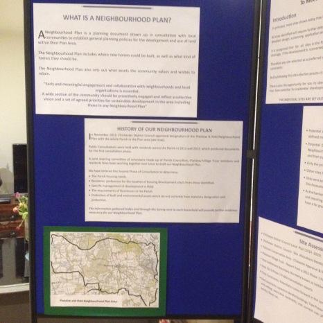
- Map 1 – Plaistow & Ifold Parish Neighbourhood Plan Area
- Map 2 – Ifold Potential Development Sites
- Map 3 – Plaistow Conservation Area (13 May 2013)
- Map 4 – Plaistow village sites
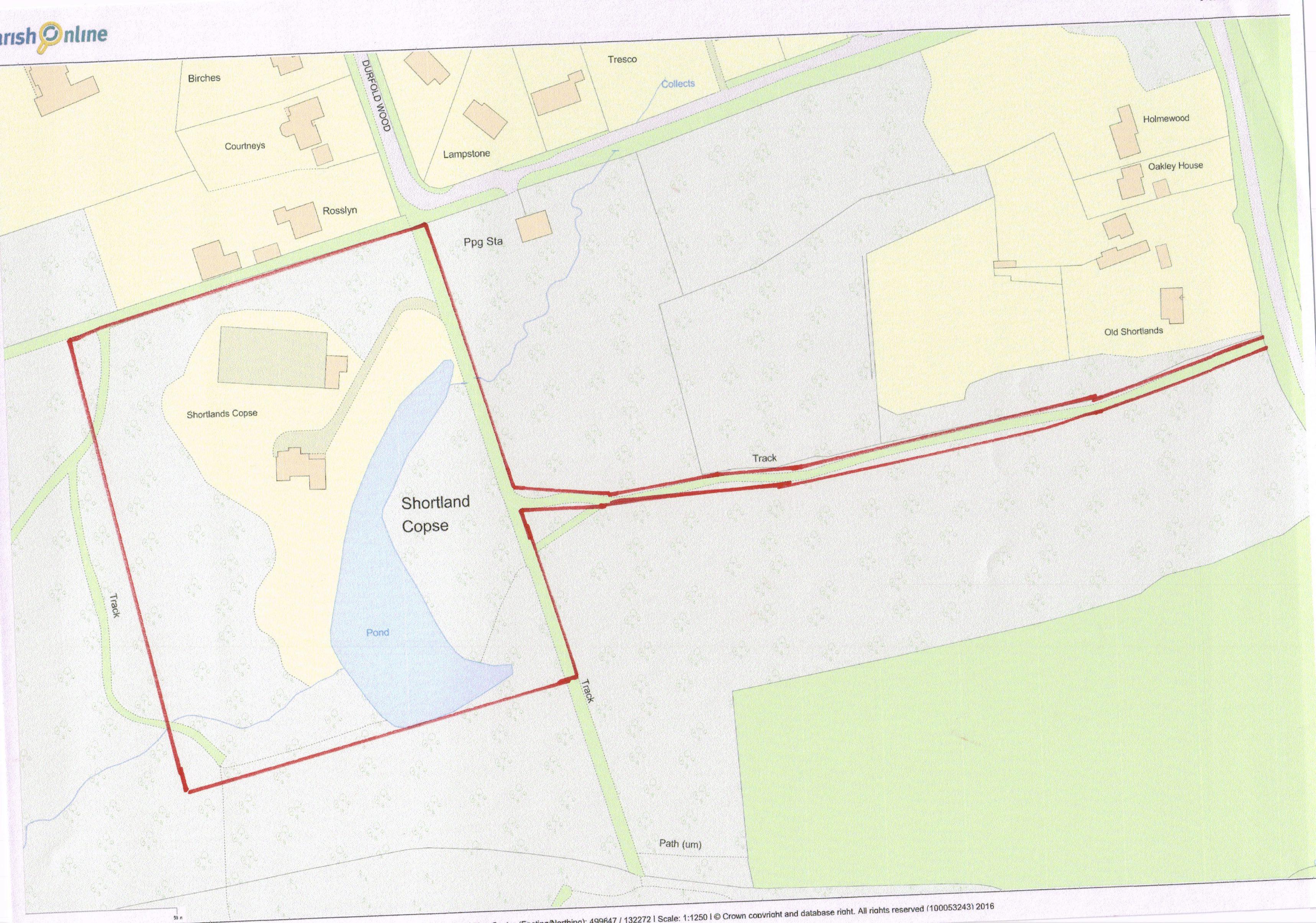
- Map 5 – Shortlands, Durfold Wood Potential Development Site
- Map 5a – Shortlands, Shortlands Copse, Durfold Wood – 2nd Sieve
- Map 6 – Old Barkfold Orchard, The Street, Plaistow
- Map 7 – Infill Dairy / St Edmunds Hill, Plaistow
- Map 8 – Barn Wood, Hogood Road, Ifold
- Map 9 – Bush House (formerly known as Clements) and Oaklands Lodge, Rickmans Lane, Plaistow
- Map 10 – Durfold Wood Potential Development Sites
- Map 11 – Strudgwick Farm, Plaistow Road, Ifold
- Map 12 – The Lane, Ifold (assessed for open space)
- Map 14 – Land Adjacent to Todhurst, The Street, Plaistow
- Map 14a – Land Adjacent to Todhurst, The Street, Plaistow – 2nd Sieve
- Map 15 – Land to the North of Little Springfield Farm, Plaistow Road, Ifold
- Map 15a – Land to the North of Little Springfield Farm, Plaistow Road, Ifold – 2nd Sieve
- Map 16 – Land Adjacent to Peacocks (Paddock opposite Oak Tree Stores), Plaistow Road, Ifold
- Map 17 – Land Opposite The Green -and- Adjacent to Common House, Plaistow
- Map 17a – Land Opposite The Green, Plaistow – 2nd Sieve
- Map 18 – Ifold Settlement Boundary (formerly known as SPA)
- Map 19 – examples of Ifold development densities: Ifoldhurst 1971 (5.8 per Hectare)
- Map 20 – examples of Ifold development densities: The Close; Wildacre Close; Bradstow Lodge
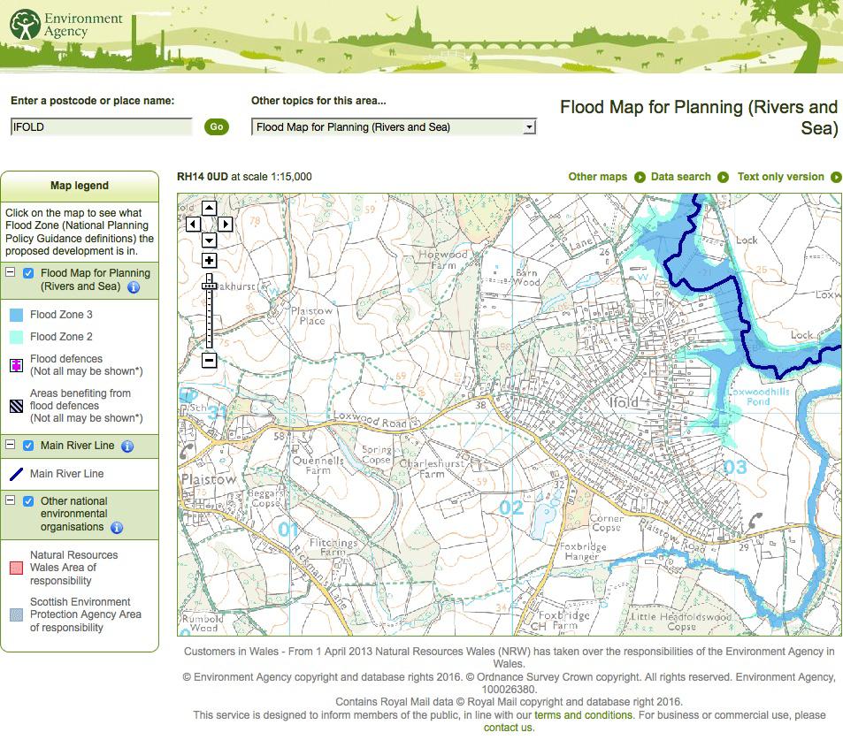
- Map 21 – Ifold Flood Zones
- Map 22 – Ifold Past and Present
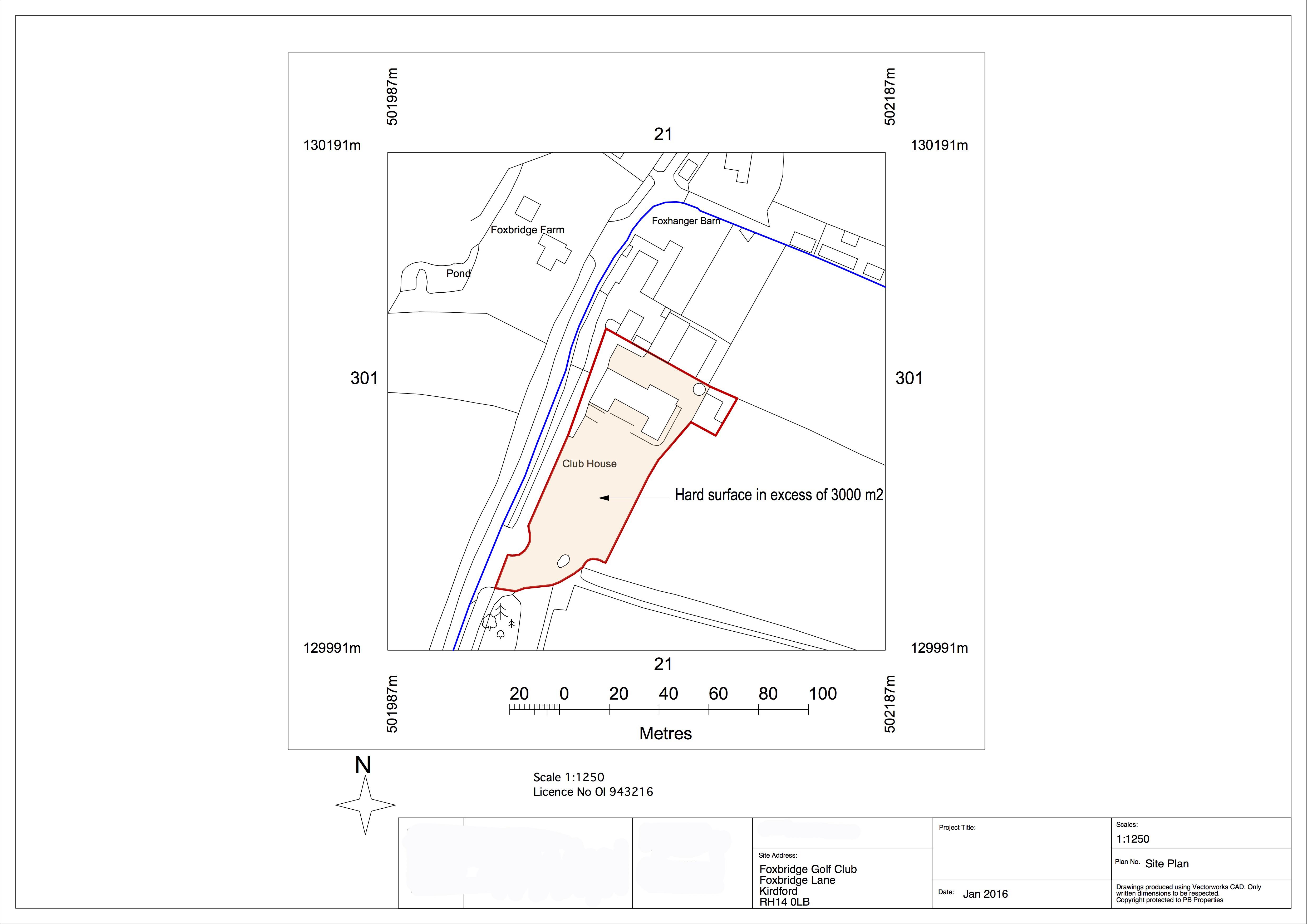
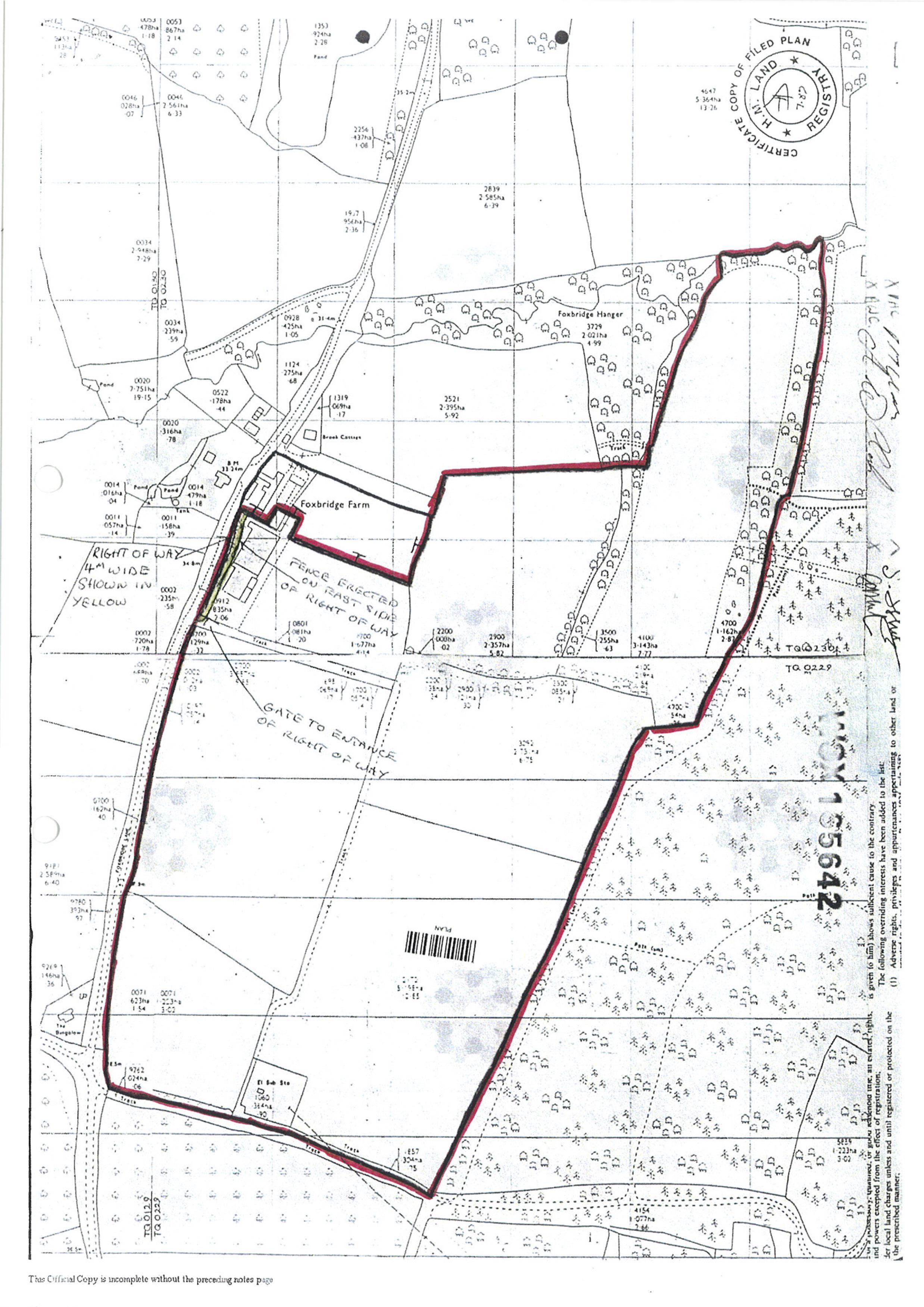
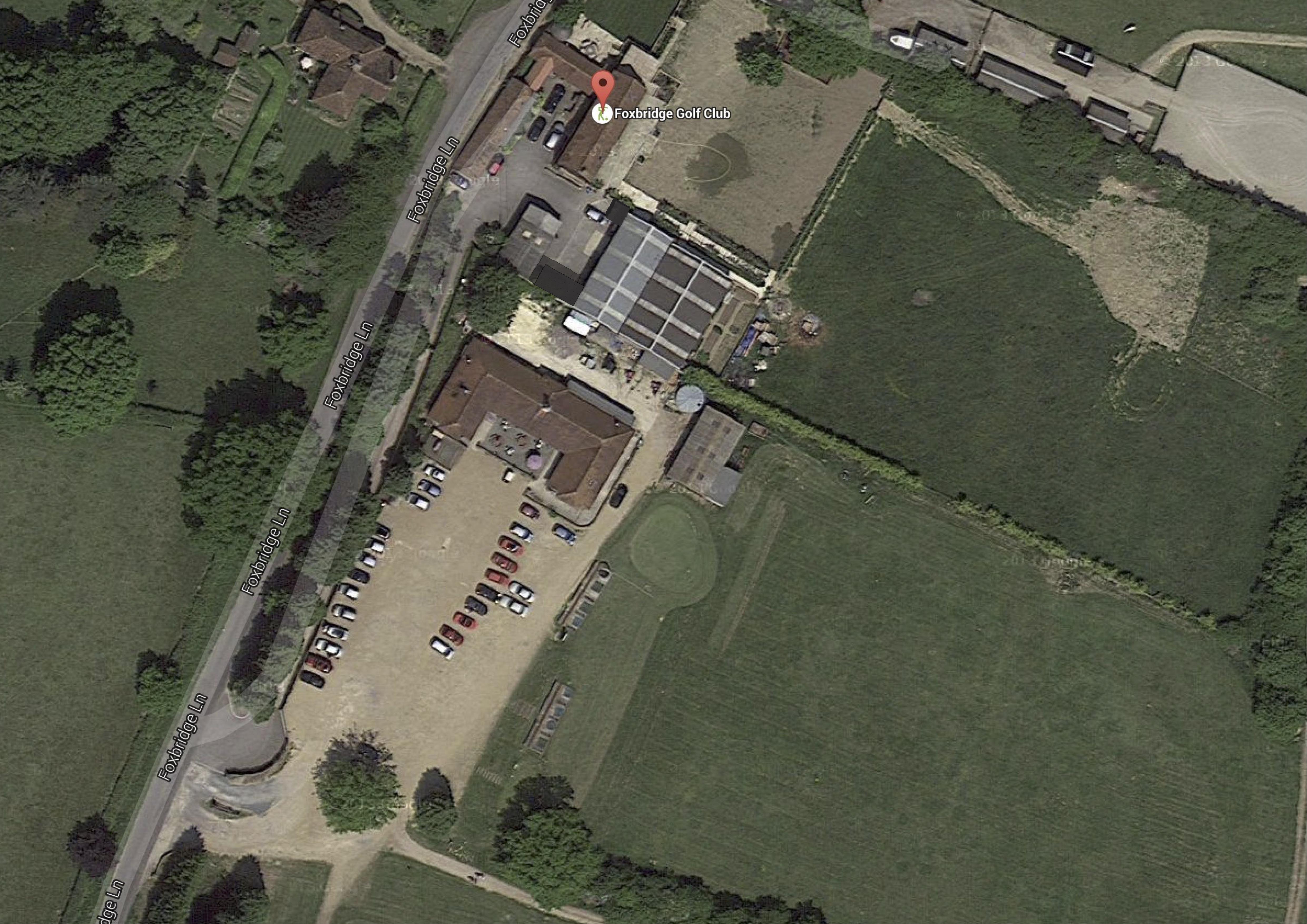
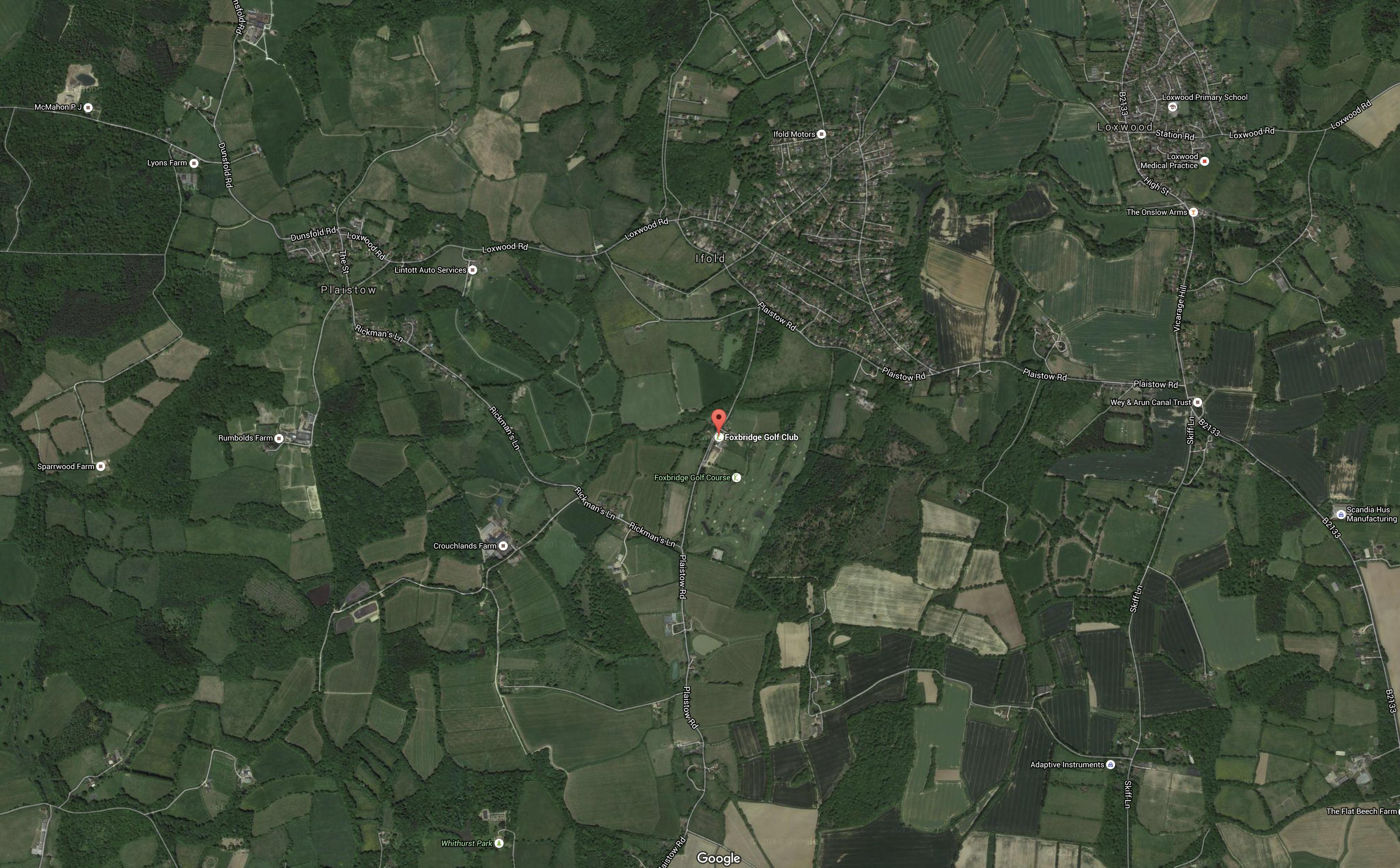
- Site – Foxbridge Golf Course
- Map 110 – Foxbridge Golf Course
- Map 200 – Foxbridge Golf Course
- Photo 300 – Foxbridge Golf Course
- Photo 400 – Foxbridge Golf Course
- Photo 1 – Plaistow village aerial
- Photo 2 – Ifold Settlement aerial
- Photo 3 – Durfold Wood aerial
- Photo 4 – Barn Wood aerial
- Photo 5 – Land to the North of Little Springfield aerial
- Photo 6 – Land adjacent to Todhurst – aerial
- Photo 7 – Land opposite Plaistow village green aerial
- Photo 8 – Shortlands, Shortlands Copse, Durfold Wood aerial
- Photo 18 – Old Barkfold Orchard, Plaistow
- Photo 19 – Old Barkfold Orchard, Plaistow
- Photo 20 – Land Adjacent to Todhurst, Plaistow
- Photo 21 – Land Adjacent to Todhurst, Plaistow
- Photo 23 – Land Adjacent to Todhurst, Plaistow
- Photo 24 – Land Adjacent to Todhurst, Plaistow
- Photo 25 – Land Adjacent to Todhurst, Plaistow
- Photo 26 – Land Adjacent to Todhurst, Plaistow
- Photo 27 – Land Adjacent to Common House, Plaistow
- Photo 28 – Land Adjacent to Common House, Plaistow
- Photo 40 – Land Opposite the Green, Plaistow
- Photo 41 – Land Opposite the Green, Plaistow
- Photo 42 – Land Opposite the Green, Plaistow
- Photo 43 – Land Opposite the Green, Plaistow
- Photo 44 – Land Opposite the Green, Plaistow
- Photo 50 – Land between Bush House (Clements) and Oaklands, Plaistow
- Photo 51 – Land between Bush House (Clements) and Oaklands, Plaistow
- Photo 60 – Strudgwick Farm, Ifold
- Photo 61 – Strudgwick Farm, Ifold
- Photo 70 – Land to the North of Little Springfield Farm, Ifold
- Photo 71 – Land to the North Little Springfield Farm, Ifold
- Photo 72 – Land to the North of Little Springfield Farm, Ifold
- Photo 73 – Land to the North of Little Springfield Farm, Ifold
- Photo 74 – Land to the North of Little Springfield Farm, Ifold
- Photo 80 – Land Adjacent to Peacocks – Paddock opposite Oak Tree Stores, Ifold
- Photo 81 – Land Adjacent to Peacocks – Paddock opposite Oak Tree Stores, Ifold
- Photo 85 – Barn Wood, Hogwood Road, Ifold
- Photo 86 – Barn Wood,Hogwood Road,Ifold
- Photo 90 – The Lane, Ifold
- Photo 91 – The Lane, Ifold
- Photo 95 – Durfold Wood
- Photo 96 – Shortlands, Shortlands Copse, Durfold Wood
- Photo 100 Shortlands, Shortlands Copse, Durfold Wood
- Photo 101 – Shortlands, Shortlands Copse, Durfold Wood
- Photo 102 – Shortlands, Shortlands Copse, Durfold Wood
- Photo 103 – Shortlands, Shortlands Copse, Durfold Wood